Envirothon
Advisers:
- Helen Bosch, hbosch@helenaschools.org
- ‘The Caffrey’, tcaffrey@helenaschools.org
Officers:
- President: Danny Leas
- Vice President: Zoey Wall
- Secretary: Elaina Patten
Where: CHS Room 232
When: Thursdays at Lunch
Who: Open to all CHS students
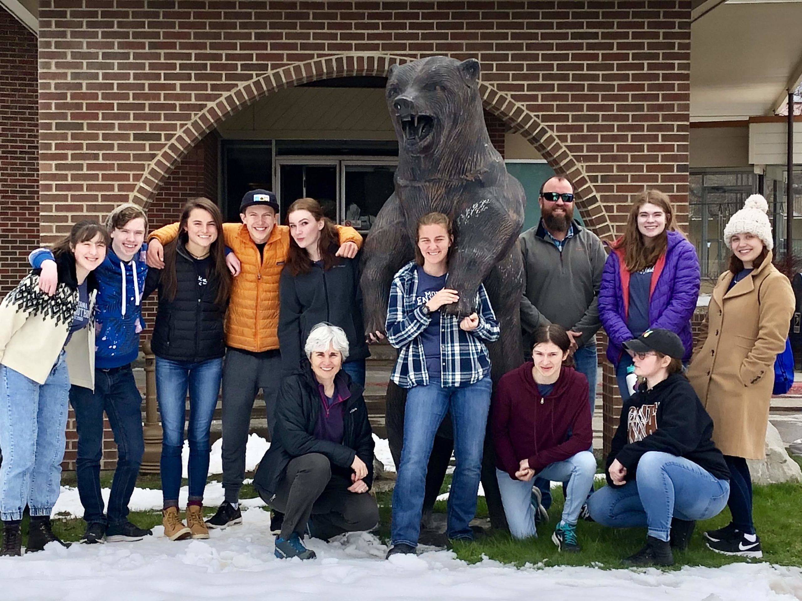


The Envirothon Team is made up of 5 members and CHS can have 2 teams. We like to also have 2 alternates. We meet weekly at lunchtime in Room 232 every Tuesday. On the third week of April, we travel to Lewistown for the state competition. Students are tested on their knowledge in five topic areas: soils and land use; aquatic ecology; forestry; wildlife; and a current environmental issue that changes each year. Through the program, students develop an understanding of effective teamwork, resource management and ecology. At the same time, they gain valuable exposure to a range of disciplines while exploring possible career paths.
National Envirothon Competition
Resources for Wildlife, Soils, Range, Forestry and Aquatics
Study materials for Wildlife, Soils, Forestry and Aquatics and the Current Issue
Video Resources
Paul Andersen – AP Environmental Science video series Video#17
Montana’s Governor Bullock’s Western Rangeland Management Initiative
Water Resource Management: Local Control and Local Solutions
Key Topics:
- Understanding how groundwater and surface water systems function.
- Understanding the importance of water quality and quantity as a foundation in a healthy ecosystem
- Understanding a variety of water quality indicators in different landscapes.
- Understanding a variety of water quantity indicators in different landscapes
- Understanding how sustainable and best management practices enhance and protect water quality and quantity for humans and wildlife.
- Understanding the differences of local, regional, and national systems that manage natural resources and the importance of each in water resources.
- Understanding the social, economic, political impacts of natural resources management and decision making.
- 2015_mt_water_plan
- executive_summary
- Key-Topic-1-3
- Key-Topic-2-3
- Key-Topic-3-1
- Key-Topic-4
- Key-Topic-5
- Key-Topic-6
- Key-Topic-7
Soils-Key Topics
- Geomorphology – Understand the concept of geomorphology and how geomorphic processes created present land forms and landscapes. Be able to relate these land forms and landscapes to soil formation and soil physical and chemical characteristics.
- Soil Formation – Understand how the 5 soil forming factors affect soil development process and the type of soil that would be present on a given landscape position (hill, terrace, ridge, slope, etc.).
- Basic Soils Knowledge – Understand basic physical properties of soils. Understand soil texture and particle size distribution and how they affect fertility, water movement, available water holding capability, and chemical properties of soils.
- Basic Map Reading and Interpretation – Understand and use topographic and soil maps to gather information.
- Soil Erosion – Wind and water and Best Management Practices (BMPs) to control erosion.
- Use of Soil Survey Publication – Find field locations in question and determine types of soils and their interpretation for given use.
- Hands-On – Texture soils and Identify A, B & C (different) soil horizons in a pit.
Learning Objectives
- To learn the importance of geology, geomorphology, and hydrogeology in natural resource studies and management planning.
- To broaden student understanding of the interconnectedness of environmental physical characteristics with biological and even sociological characteristics. Why are industries located where they are? In many cases it is due to geological characteristics of the area. Why are farms located where they are? Soil type plays a critical role in agricultural production.
- To learn basic geological and soil identification methods so that field site characterization can be performed at a variety of sites.
- To develop an ability to determine physical site characteristics from maps, soil surveys and other methodologies common to geology and soil science.
- To develop an understanding of the concept of Best Management Practices and learn how to identify practices which are most compatible with specific soil and substrate types.
- To broaden awareness of the varied human demands on physical resources and address conflicting land use demands with regard to best suitable uses.
Basic Skills
- Soil Texturing
- Identification of major soil horizons
- Use clinometer, compass, or similar instruments for determining slope percent & aspect.
- Basic plant identification of key plants associated with major land types.
- General map reading skills on primarily aerial photography and USGS topographic surveys to delineate land forms, contours, slope, aspect, floodplains, etc.
- Basic skills in use of a stereoscope for aerial photography interpretation.
Critical Facts
- All soils are derived from underlying parent materials which are affected by geological processes.
- Water quality is directly related to sediment types. Sediment types affect the impact of pollution on water quality . Groundwater moves through a clay layer at a rate as low as one inch per two years, while water moving through beach sand can travel up to five feet per day. Groundwater pollution in the former situation is much slower to recover. Although the polluted plume does not spread quickly, the clay makes it impossible to pump out.
- Soil stewardship became a national issue in the 1930’s with the Dust Bowl. Erosion problems began in colonial times. Farmers did not adapt European farming methods to the different climate in North America where water events occur more frequently as storms producing greater volumes of precipitation during shorter time intervals. Farmers also grew the same cash crop every year until the soil was depleted. Then they moved on and farmed elsewhere due to the cheapness of land. Later, more industrial-sized equipment such as the tractor was developed, enhancing the depletion of the soil layer. By the late 1940’s nearly all privately owned land in the Nation was part of a conservation district designed to promote soil stewardship.
- Soil erosion continues to be a serious problem in Montana. Wind and water erosion are occurring on Montana cropland at a rate of 132 million tons per year.
- Scobey Clay Loam is the unofficial State Soil for Montana., representing over 750 different soils found in Montana. Scobey State Soil
Soil: The foundation of Agriculture
Is More Cattle Grazing the solution to Saving our Soil?
Publication
- Published Soil Surveys by County Contact Local NRCS Office For Availability.
- Soil Quality Information Sheets Available at NRCS Offices
- Munsel Color Book Contact Local NRCS Office For Availability.
- Fertilizer Guidelines for Montana MSU Extension #EB 104 1992
- Fundamentals of Soil Science Local Library, college text
Roth, Henry D. John Wiley & Sons, N.Y. - Soil Sampling MSU Extension#MT8602AG 1993
- Soil Testing Procedures, Interpretation MSU Extension#MT8704AG
and Fertilizer Sources. 1987 - Geologic Parent Materials of Montana MSU Extension #1B721 1980 ($5.00)
- Soils of Montana MSU Extension #1B744 1982 ($5.00)
- Soils and People MSU Extension #2F093
- Protect Soil With Vegetative Residues
MSU Extension#MT8362AG 1984 - Saline Seep in Montana MSU Extension#MT8310AG 1983
- The Nature & Properties of Soils Local Library, College Text
Brady, Nyle C. 8th ed. 1974 - Soil Science Simplified Local Library
Harpstead, Milo I. 1980 Iowa State Univ. Press - Roadside Geology of Montana Local Library or Bookstore
Alt, David & Hyndman, D. W. 1986 ($12.95) - Montana In The Geologic Past MT Bureau of Mines & Geology
Bulletin #26 Perry, Eugene S. 1962 - Northwest Exposures: A Geologic Story Of The Northwest.
Local Library or Bookstore ($24.00)
Alt, David & Hyndman, D. W. 1995
Rangeland
Key Topics/Learning Objectives
- Basic rangeland knowledge, to include: identification of state grass, plant I. D. and definitions, importance of rangelands in Montana.
- Range Ecology Processes – definition of ecological sites (soil – plant relationships), ecological processes (energy flow, nutrient cycle, water cycle and plant succession).
- Rangeland Management – stocking rates/carrying capacity, general types of grazing systems, improvement practices (fencing and water developments), wetland, riparian and upland communities.
- Basic knowledge of livestock and wildlife interactions, forage preferences, forage overlap, and habitat requirements.
Learning objectives:
- Define rangeland, % of state encompassed by rangeland, importance of rangelands.
- Identify state grasses of Montana, differentiate between plant types (grass, forb, shrub, and trees), identify parts of a grass and/or grasslike species.
- Define rangeland ecological sites, understand ecological process, understanding of all definitions inclusion to all key topic areas.
- Understanding of basic rangeland management concepts, i. e. grazing systems, stocking rates, and rangeland improvements.
- Understanding of Best Management Practices (BMPs) on rangeland and how different communities (wetland, riparian, and upland areas) interact.
- Recognize different classes of livestock and understand their interaction with wildlife species.
Rangeland links:
Interpreting Indicators of Rangeland Health
Aquatics/Water
Key Topics/Learning Objectives
- Understanding of the basic hydrologic cycle and hydrology including surface and ground water characterization. Identify how local hydrology is affected by geological characteristics. Fundamentals of watershed Fundamentals of Watershed Hydrology and Water cycle
- Understand what a watershed is and why watershed management is an important tool for addressing water quantity and quality issues. Learn how to determine watershed boundaries. Learn what factors contribute to successful watershed planning and management. Watershed delineation
- Have an understanding of aquatic, riparian, and wetland ecosystems in a watershed. Ecological systems of Montana and Riparian Wetland
- Learn to identify aquatic invertebrates common to Montana and learn their ecology. Also understand the user of aquatic macroinvertebrates in predicting and monitoring water quality.This would require identification of aquatic macroinvertebrate species which may indicate water characteristics (temp, oxygen content, tds concentrations, etc) and the special morphological features these species may have for those environments.
- Learn to identify fish species common to Montana Fish of Montana, and learn their ecology. This would require identification of fish species which may indicate water characteristics (temp, oxygen content, tds concentrations, etc) and the special morphological features these
species may have for those environments. Fish ID - Learn the different types of aquatic and wetland ecosystems in a watershed determining components.
- Learn major human impacts on water quality and quantity and develop an understanding of management practices which can reduce of eliminate adverse impacts on the water resource. Learn to identify major sources of point and non-point source pollution. Learn the major impacts of impaired water quality on humans, livestock, and wildlife. Human interaction and affect on ground and surface water
- To expand an awareness of basic hydrology and the watersheds including determination of water discharge and recharge areas and an understanding of a water budget.
- To learn the basic measurement methods for indicators of water quality and how to apply these methodologies.
- To learn the basic physical and chemical properties of water. A basic knowledge of how these properties effect the geological features that come in contact with water. Chemical properties that should be reviewed would include, but are not limited to alkalinity, osmosis, hardness, total dissolved solids, and dissolved oxygen should familiar to the participants. Physical properties that should be reviewed would include but are not limited to conservation of energy, sediment transport, energy grade lines.
Forestry
Key Topics
- Basic Forestry Knowledge; such as tree identification, silvics of
common trees, tree measurement and tool use, and interaction of forests and environment. - Forest Ecology; such as the observation and identification of forest types, observing and describing forest stand structure, observing and
describing site variables that affect tree species, and observing and identifying the stages of forest succession. - Silviculture Systems- such as describing the difference between harvesting and silvicultural systems, describe the difference between the goal of thinning and final harvest, describe the purpose of common silvicultural systems, and describe the management practices and their purpose.
- Viewing Ecosystems; such as the observation of how trees and forests impact soil development, wildlife habitat, public places, agriculture, and on water quality.
- Urban Forestry; such as the recognition of the value of trees in the urban landscape, choosing the correct species for specific locations, energy conservation through three plantings, urban wildlife benefits from tree plantings methods, proper tree care and maintenance, including wise choices in pest and disease control.
Learning Objectives
- Identify common trees without a key.
- Identify specific or unusual species of trees or shrubs through the use of a key.
- Understand how wildlife habitat relates to: forest communities, forest species, forest age structure, snags and den trees, availability of food and cover, and riparian zones.
- Understand basic forest management concepts.
- Be familiar with use of a diameter tape and other forestry tools.
- Understand the benefits of trees in urban/suburban settings and the factors affecting their health and survival.
Description of Learning Objectives:
- Basic forestry knowledge involving the use of leaves, bark or twigs to identify common tree species of Montana (using a key if necessary), understanding rooting habit, shade tolerance, soil, and other characteristics of common tree species, identify and use such tools as a Biltmore stick, abney level or clinometer, prism or angle gauge, calculating the annual diameter growth by using annual ring measurements, understanding and explaining the use of basal area in forest management, and describing the effects of trees and forest on temperature, wind, sounds, and other variables.
- Forest ecology involving the identification and description of adaptations for common trees associated with forest wetland systems, streamline forest systems, upland forest systems, old field sites, recognizing the different layers of vegetation found within most undisturbed forest stands, recognizing and evaluating variables, related to site such as depth to water table, soils, shade level and their effects related to tree species survival and growth, and recognizing and describing the process of secondary forest succession for old field and harvested sites.
- Silviculture involving the explanation of the difference between clear-cut harvest and clear-cut silvicultural system, explain the difference between a thinning, diameter-limit cut and the single-tree selection system, understanding and explaining the difference between even-aged and uneven-aged management systems, listing probable reasons why a logger and a forester might select different trees for harvest, defining the goals of thinning in comparison to the goals of final harvest, outlining the goals and approaches used by the major silvicultural systems to insure stand regeneration after harvest, and be able to list at least five best management practices used to control flow of water on a harvest site and describe the situation where they are appropriately used.
- The viewing of ecosystems where the goal at each site is to assess the whole area while addressing questions on the various components you are asked to observe and understand.
- To understand the importance and benefits of trees in the urban habitat for a wide variety of reasons, including wildlife habitat, windbreaks, energy conservation, shade benefits, erosion control, aesthetics and others. To understand proper care of trees in the urban environment.
Critical Facts:
- Trees and forests occur in certain locations for certain reasons that are often identifiable by observing the site and the larger area surrounding the site. These may be as simple as the soil type, the amount of soil moisture, or need for a park or natural area within a residential area.
- Highly productive soils are often used for agricultural production and would also support a highly productive forest. As sites become less acceptable for agriculture due to drought or wet soils, certain tree species and forest types can still maintain high levels of productivity on many of these sites.
- As the amount of soil moisture on a site increases, there is a change in the types of vegetation that become dominant. Wetland sites have special combinations of tree species, shrubs, and herbaceous plants that are part of the important functions these sites contribute to the environment.
- Wildlife habitat is affected by the age, size, density, variety of tree species, and location of the trees or forest stands in relation to surrounding ecosystems such as residential areas, other wooded areas, streets and water sources. The level of importance of trees is dependent upon the ecosystem (prairie, wetland, agricultural field, forest) and the wildlife being studied.
Minimum Recommended Biota List:
- Lodgepole Pine Pinus contorta
- Ponderosa Pine Pinus ponderosa
- Western White Pine Pinus monticola
- Whitebark Pine Pinus albicaulis
- Limber Pine Pinus flexilis
- Alpine Larch Larix lyallii
- Western Larch Larix occidentalis
- Engelmann Spruce Picea engelmannii
- Douglas-fir Pseudotsuga menziesii
- Western Hemlock Tsuga heterophylla
- Mountain Hemlock Tsuga mertensiana
- Grand Fir Abies grandis
- Alpine Fir Abies lasiocarpa
- Western Red Cedar Thuja plicata
- Rocky Mountain Juniper Juniperus scopulorum
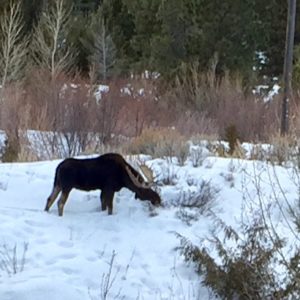 Wildlife
Key Topics
- Types of Habitat (Wetlands, Range, Forest)
- Wildlife (Birds, Mammals, Reptiles, Amphibians) common to Montana and their Habitat requirements.
- Natural processes affecting wildlife and habitat (Succession, Competition, Fire, Precipitation).
- Interactions between people, wildlife and habitat.
Learning Objectives
- To learn how to recognize wildlife habitats and the effects of fire on wildlife habitats.
- To learn the common kinds of wildlife found in each habitat.
- To learn how management (preservation, conservation, and manipulation) of wildlife habitat interrelates with fire management.
- To learn the relationships between people, wildlife, and fire management.
- To learn how to deduce solutions to problems through teamwork with the information at hand.